 On this edition of Urban Impact, you will read about how UN-Habitat is supporting access to clean water for citizens of Hargeisa (Somaliland), Somalia, through the establishment of a new water system as well as constructing a new water supply and storm drainage system for the citizens of Kanyama, the largest informal settlement in Zambia.
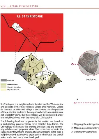
Urban Development Initiative (UrDI) For the Canaan Area of Port-Au-Prince, Neighbourhood Plan: St. Christophe, 2016
Other documents
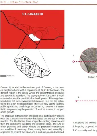
Urban Development Initiative (UrDI) For the Canaan Area of Port-Au-Prince, Neighbourhood Plan: Canaan III, 2016
Other documents
Urban Development Initiative (UrDI) For the Canaan Area of Port-Au-Prince, Neighbourhood Plan: Canaan I, 2016
Other documents
Urban Impact - Issue 02
Legacy content
- Total value of UN-Habitat investments (2008-2015): US$ 23,724,354
- Total number of UN-Habitat projects (2008-2015): 12 projects
- Main donors: CERF, Irish Aid, USAID, UNDP, ECHO-European Union, BASF AG, Fond pour La Reconstruction d'Haiti, UNDG, Iraq Trust Fund, BRSP/UNDP, European Union, AECID, UN-Habitat IDF, European Commission and, the Africa, Caribbean and Pacific Secretariat
- Implementing partners: The Joint Task Force, The Ministry of Public Works, Municipalities, US Army, NSET, Emergency Architects Foundation, UNDP, UNV,UNOPS, UNOSAT, NGOs, Private sector, MINUSTAH, Shelter Cluster members and other IASC cluster leads and members and media,military engineers, ILO, Ministere des Travaux Public, des Transports et Communication, Ministere de la Planification et de la Cooperation Externe, Mairie de Port-au-Prince, Mairie de Petionville, UNDP, UNFPA, UNEP, Cooperation an Developpement de la Suisse (SDC)
General information
Capital: Port-au-Prince
Major cities: Port-au-Prince, Carrefour, Delmas, Pétionville, Croix des Bouquets, Jacmel, Cap-Haïtien
- Population: 10.17 Million
- GDP: US$7.843 Billion
- GDP growth: 2.8%
- Urban population (annual %): 55%
- Population growth rate (average annual %): 1.4%
- Urban population growth rate (average annual %): 3.8%
- Rural population growth rate (average annual %): -1.5%
Source: World Bank 2012
UN-Habitat projects in Haiti
Renovation of Place de la Paix, Les Cayes
This project involved rehabilitating and upgrading Place de la Paix - a play and multi-purpose park localed on Tikok, the poorest slum in Les Cayes. The site is the only existing public space in the area.
Project Duration: 2014 - 2015
Value USD: 120,000
Donor: Mojang
Implementing Partners: Municipality of Les Cayes
Renovation of Plage la Touterelle, Les Cayes
Plage de la Touterelle is part of the Les Cayes Waterfront. It lacks sanitary faciliteis, lighting, street furniture, garbage disposal facilites and parking space. The project involves community participation in revitalizing the waterfront. The youth in the community were engaged in a Minecraft particpatory design workshop for the renovation of the waterfront. They prioritized securing the beach from erosion, construction of sanitary facilites, provision of beach furniture, reconstruction of existing kiosk and construction of a paviliion. Work is on-going.
Project Duration: 2015 - ongoing
Value USD: 83,000
Donor: Mojang
Implementing Partners: Municipality of Les Cayes
Port-Au-Prince Extension Plan and Retrofitting Canaan
UN-Habitat is providing support for post-disaster planning in Canaan, Haiti. After the 2010 earthquake, many residents lost their homes and moved from Port-au-Prince into Canaan. UN-Habitat is developing a plan that will provide a core street layout with public spaces and amenities so that future development can take place in a more controlled manner that avoids slum development.
Project Duration: 2015 - ongoing
Value USD: 300,000
Donor: USAID
Implementing Partners: UN-Habitat Office in Haiti, City Planning Department, Various National Government Ministries
Emergency and Recovery Response to Haiti Earthquake (CERF)
To enable 144,000 families to re-occupy their homes or safe land through the provision of technical assistance and coordination support for the damage assessment of 70% of damaged and destroyed buildings, (including homes and service buildings) in 50 neighbourhoods within a 3 month period.
- Duration: March 2010 - March 2011
- Value: US$ 2,529,962
- Donor: CERF
- Implementing partners: the Joint Task Force, The Ministry of Public Works, Municipalities, US Army, NSET, Emergency Architects Foundation, UNDP, UNV,UNOPS, UNOSAT, NGOs, Private sector, MINUSTAH, Shelter Cluster members and other IASC cluster leads and members and media.
- Location: Port-au-Prince, Carrefour, Jacmel, Petit Goave, Leogane
UN-Habitat Emergency and Recovery Response to Haiti Earthquake
Earthquake affected homeowners and local decision makers involved and supported in the shelter and housing recovery and reconstruction process.
- Duration: March 2010 - December 2011
- Value: US$ 244,972
- Donor: Irish Aid
- Implementing partners: Ministry of Public Works, Municipalities, NSET, Emergency Architects Foundation, UNDP, UNV, UNOPS, UNOSAT, NGOs from Shelter Cluster, Private sector, MINUSTAH military engineers
UN-Habitat Emergency and Recovery Response to Haiti Earthquake
Earthquake affected homeowners and local decision makers involved and supported in the shelter and housing recovery and reconstruction process.
- Duration: March 2010 - March 2011
- Value: US$ 1,500,000
- Donor: USAID
- Implementing partners: Ministry of Public Works, Municipalities, NSET, Emergency Architects Foundation, UNDP, UNV, UNOPS, UNOSAT, NGOs from Shelter Cluster, Private sector, MINUSTAH military engineers
Management of debris from the earthquake in the slums of Port-au-Prince
Rehabilitation of urban areas of Port-au-Prince, setting up a recycling system, removal and treatment of debris in the Port-au-Prince area.
- Duration: January 2011 - December 2012
- Value: US$ 1,598,326
- Donor: UNDP
- Implementing partners: UNDP, ILO, Ministere des Travaux Public des Transports et Communication, Ministere de la Planification et de la Cooperation Externe, Mairie de Port-au-Prince, Mairie de Petionville,
- Location: Carrefour Feuilles, Brisetout-Bobin, Ravine Pintade, Christ-Roi
Coordination of the Haiti Shelter Cluster by UN-Habitat
To ensure equitable shelter assistance to the affected population throughout all affected areas, with a focus on most vulnerable groups, and improve consistency between emergency and transitional shelter assistance and people's strategies, while developing adequate guidelines and coordination framework for shelter recovery and reconstruction activities.
- Duration: January 2011 - December 2012
- Value: US$ 463,743
- Donor: ECHO-EU
- Location: Areas affected by the earthquake
UN-Habitat Emergency and Recovery Response to Haiti Earthquake: Community-based response to Cholera
Earthquake affected homeowners and local decision makers involved and supported in the shelter and housing recovery and reconstruction process.
- Duration: January 2011 - December 2011
- Value: US$ 261,262
- Donor: CERF
- Implementing partners: Ministry of Public Works, Municipalities, NSET, Emergency Architects Foundation, UNDP, UNV, UNOPS, UNOSAT, NGOs from Shelter Cluster, Private sector, MINUSTAH military engineers
- Location: Port-au-Prince, Carrefour, Jacmel, Petit Goave, Leogane
UN-Habitat Emergency and Recovery Response to Haiti Earthquake
Earthquake affected homeowners and local decision makers involved and supported in the shelter and housing recovery and reconstruction process.
- Duration: March 2010 - December 2013
- Value: US$ 262,405
- Donor: BASF AG
- Implementing partners: Ministry of Public Works, Municipalities, NSET, Emergency Architects Foundation, UNDP, UNV, UNOPS, UNOSAT, NGOs from Shelter Cluster, Private sector, MINUSTAH military engineers
Debris management in support to returning populations affected by the earthquake
Reinforce the capacities of Cuban municipalities (Bayamo, Bartolomé Masó, Holguín, Mayarí, Santa Clara, Camajuaní, Cienfuegos and Cruces) and citizens to adapt to climate change and risk reduction through south-south cooperation and pilot projects related to local building materials and environmental urban improvement.
- Duration: June 2011 - September 2013
- Value: US$ 2,643,170
- Donor: Fond pour La Reconstruction d'Haiti
- Implementing partners: UNDP, ILO, Ministere des Travaux Public des Transports et Communication, Ministere de la Planification et de la Cooperation Externe, Mairie de Port-au-Prince, Mairie de Petionville
- Location: Bolosse, Turgeau, Gros Morne, Nerette and others as recommended by the MTPTC
UNDG-HRF (Haiti Reconstruction Fund)
Support the reconstruction of housing and neighbourhoods in Haiti in providing the Govt, the Interim Haiti Recovery Commission and to the technical and financial partners the basic tools for decision and coordination making processes.
- Duration: July 2011 - July 2014
- Value: US$ 10,266,140
- Donor: UNDG, Iraq Trust Fund, BRSP/UNDP
- Implementing partners: ILO, UNDP, UNFPA, UNEP
- Location: Port-au-Prince agglomeration, Axis Leogane - Petit Goave, Axis Jacmel-Marigot, Les Cayes, Cap Haitien, Saint Marc
Support Programme for the Neighbourhoods Reconstruction and Planning
To support the resettlement of displaced populations by creating decent and safe conditions for their return to their neighborhood of origin.
- Duration: August 2011 - December 2014
- Value: US$ 2,662,000
- Donor: EU
- Location: Port-au-Prince
Reconstruction project in Jacmel
Reconstruction with a view to sustainable improvement of Housing and Living conditions of the population affected by the 12 January 2010 Earthquake in the Southeast
- Duration: July 2012 - December 2014
- Value: US$ 1,292,374
- Donor: AECID Cooperation an Developpement de la Suisse (SDC)
- Location: Jacmel
Participatory Slum Upgrading Programme
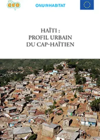
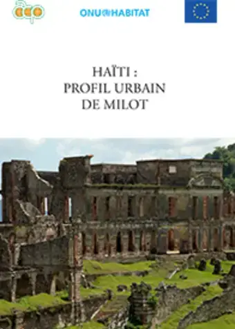
Implementation of this programme aims at improving access to secure tenure, infrastructures, basic urban services, and sanitation particularly in the selected cities of Cap Haitien and Milot, thus adding value to the current initiatives developed by the Ministry in urban planning.
- Duration: October 2013 – December 2015
- Donor: European Commission and the Africa, Caribbean and Pacific Secretariat
- Implementing Partners:UN-Habitat and Comité Interministériel d’Aménagement du Territoire
- Profile cities/ location: Cities of Cap Haitien, Milot and Les Cayes
Images
Image
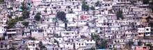
Port-au-Prince, Haiti. © UN-Habitat